

North and South America, between them, host the driest non-polar desert on Earth. They also hold four distinct named deserts within one country, plus a sand-dune oasis town built around a single natural lake.
Table Of Content
- The Atacama
- Peru’s Ica Region (Huacachina)
- North America’s Four Named Deserts
- Why the Atacama and the Namib Are Often Compared
- Why South America’s Desert Geography Is Often Overlooked
- A Note on Scale Across This Topic
- Related Topics
- FAQ
- Why is the Atacama considered the driest desert on Earth, excluding polar deserts?
- Why does the southwestern United States have four different named deserts so close together?
- Has any location in the Atacama genuinely never recorded rainfall?
- How does the Atacama compare to Namibia’s Namib Desert?
- Why doesn’t South America’s desert geography get as much general attention as the Sahara or the American Southwest?
The Atacama
Britannica’s entry on the Atacama Desert attributes its extreme dryness to two reinforcing mechanisms: dry subsidence from the South Pacific high-pressure cell, combined with a thermal inversion produced by the cold Peru, or Humboldt, Current. Together, they produce fog and stratus clouds but almost no rain. This is the primary worked example behind Coastal Fog Deserts. The desert stretches roughly 1,000 kilometers along the coast, and some of its weather stations have never recorded measurable rainfall at all. That extreme, consistent dryness also makes it one of the world’s premier stargazing locations.
Peru’s Ica Region (Huacachina)

The Huacachina oasis near Ica, Peru, sits in a natural desert depression fed by underground water. It’s surrounded by some of the tallest sand dunes in South America, and it’s the worked example behind Desert Oases: How They Form.
North America’s Four Named Deserts
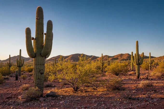
The southwestern United States hosts four distinct named deserts within a relatively compact region. The Sonoran and Mojave are both hot deserts. The Great Basin, by contrast, is a cold desert, its aridity driven by rain-shadow and continental-interior effects.

The fourth, the Chihuahuan, rounds out a genuinely rare concentration of desert-type diversity within one country. Each of these four deserts illustrates a different formation mechanism or classification covered elsewhere in this Hub. As a result, the American Southwest is one of the most mechanistically diverse desert regions on Earth, relative to its geographic size.
Why the Atacama and the Namib Are Often Compared
Both the Atacama and Namibia’s Namib Desert share the same underlying coastal-fog-desert mechanism: a cold ocean current suppressing rainfall while still producing fog. Comparing the two side by side, in fact, is one of the clearest ways to see that mechanism play out on two entirely different continents.

Why South America’s Desert Geography Is Often Overlooked
Compared to the Sahara or the American Southwest’s deserts, South America’s arid regions receive comparatively little general-audience attention. That’s despite hosting genuinely extreme and scientifically significant terrain. The Atacama’s status as the driest non-polar desert on Earth, for instance, is a fact many travelers encounter for the first time through content like this atlas, rather than general cultural familiarity.
A Note on Scale Across This Topic
The deserts profiled here range enormously in size, from the Atacama’s roughly 1,000-kilometer coastal stretch down to Huacachina’s single small oasis town. That’s a useful reminder that “desert” as a category spans everything from continent-scale arid zones to one small, geographically tiny depression. The four named deserts of the American Southwest add a further contrast, too. Each is individually more modest in scale than the Atacama, but together they illustrate a genuinely wide range of formation mechanisms within one relatively compact national region.
Related Topics
Coastal Fog Deserts · Desert Oases: How They Form · World Deserts Atlas
FAQ
Why is the Atacama considered the driest desert on Earth, excluding polar deserts?
Its dryness is compounded by two reinforcing mechanisms: the cold Humboldt Current suppressing rainfall, and an additional rain-shadow effect from the Andes. That double cause is genuinely rare among the world’s deserts.
Why does the southwestern United States have four different named deserts so close together?
The region’s varied terrain, plus its position relative to multiple mountain ranges and the Pacific Ocean, creates several distinct formation mechanisms. Rain shadow and continental-interior effects both operate within relatively short distances of each other.
Has any location in the Atacama genuinely never recorded rainfall?
Yes. Certain weather stations within the desert have documented records showing no measurable rainfall at all across their monitoring period. That’s among the strongest evidence for its status as the driest non-polar desert on Earth.
How does the Atacama compare to Namibia’s Namib Desert?
Both share the same core mechanism: a cold ocean current that suppresses rainfall while still generating fog. That makes them a useful side-by-side comparison of the same climate process operating on two different continents.
Why doesn’t South America’s desert geography get as much general attention as the Sahara or the American Southwest?
It’s largely a matter of cultural familiarity rather than scale or significance. The Atacama’s status as the driest non-polar desert on Earth, after all, is a genuinely striking fact many people encounter for the first time through reference content rather than general awareness.