


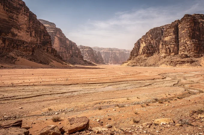
A wadi looks completely dry almost all year. That is exactly what makes it dangerous the few times it isn’t, and why local guides treat a clear sky overhead as no guarantee of safety at all.
Table Of Content
- What Is a Wadi?
- Why Wadis Flood So Suddenly
- Why Desert Soil Makes It Worse
- Why This Is a Real, Documented Hazard
- Worked Example: Petra, 1963
- Slot Canyons: A Related, Amplified Risk
- How Wadis Relate to Other Desert Water Features
- What This Page Covers
- Related Topics
- FAQ
- Does a wadi need to be raining locally to flood?
- Is a wadi the same thing as an oasis?
- How much advance warning do flash floods in wadis typically give?
- Why are slot canyons even more dangerous than open wadis?
- Is arroyo just the American term for wadi?
What Is a Wadi?
A wadi is a valley, gully, or streambed that carries water only during and immediately after rainfall. The rest of the year, it stays completely dry.
The term is used widely across the Middle East and North Africa. Jordan’s Wadi Rum, a 720-square-kilometer sandstone and granite valley protected as a UNESCO World Heritage Site, is one of the most famous examples.
The same landform exists under other names elsewhere. In the American Southwest, people call it an arroyo. The mechanism behind both is identical.
Why Wadis Flood So Suddenly

Desert rainfall is rare, but it often falls intensely when it does occur. That intensity, combined with the terrain, is what turns an ordinary storm into a fast-moving hazard.
Rain falling a significant distance away can funnel rapidly into a wadi’s channel. A flash flood can then reach a location within minutes, often with no rain falling there at all.
NOAA’s National Weather Service defines flash flooding as flooding that begins within six hours of the triggering rainfall, and often within three. That narrow window is a major reason these events are so hard to forecast with real advance warning.
Why Desert Soil Makes It Worse
Rain falling on farmland usually soaks in. Rain falling on desert ground frequently does not, and the difference comes down to the surface itself.
Many desert surfaces carry a hardened crust, compacted soil, exposed bedrock, or a layer of desert pavement. USGS research on flood mechanics notes that this kind of crust can reduce infiltration by a factor of a hundred or more compared to the soil beneath it.
Water that cannot soak in has to go somewhere. In a wadi’s drainage basin, it goes downhill, fast, and it arrives as runoff rather than absorption.
Why This Is a Real, Documented Hazard
A wadi channel can look completely dry and safe right up until water arrives with little warning. Sometimes it arrives as a fast-moving wall of water and debris, rocks, branches, and other material, rather than a gradual rise.
Roads that cross dry wadi beds without a bridge are a particular risk point. A driver can encounter clear weather at the crossing and still meet a flood generated by a storm many kilometers upstream.
Worked Example: Petra, 1963
Petra sits inside a network of wadis and narrow canyon approaches, including the famous Siq entrance. In 1963, a flash flood swept through the site and killed 22 French tourists and their guide, none of whom saw rain falling where they stood.
Jordan responded by building a dam to divert water away from the area around the Treasury, and added a siren system in 2014 that triggers automatically once floodwater rises above four meters.
The lesson carries beyond Petra. Even a well-studied, heavily visited site needed physical infrastructure, not just awareness, to make wadi flooding survivable.
Slot Canyons: A Related, Amplified Risk
Narrow slot canyons form through the same water-erosion processes covered in Badlands and Erosion Landscapes, and they amplify wadi flood risk considerably.
A storm on a mesa or plateau miles away can send a flood sweeping through a slot canyon with almost no warning at ground level. The canyon’s narrow, steep walls make climbing out of the way genuinely difficult in the time available.
This is why several well-known desert park systems close slot canyons automatically whenever rainy-season forecasts flag risk upstream, regardless of conditions at the canyon entrance itself.
How Wadis Relate to Other Desert Water Features

A wadi’s occasional floodwater often becomes the same water that later feeds a downstream aquifer or evaporates into a desert basin. Desert Oases: How They Form covers the aquifer side of that system, and Salt Flats and Playas covers the evaporation basin side.
These three landforms are frequently linked stages of the same regional water system. This page treats wadis separately for clarity, but none of them work in isolation.
What This Page Covers
This page explains why wadi flash floods happen, as a matter of desert climate science. It does not teach flood-survival or navigation techniques, which is a distinct skill set the Experience Hub covers separately under Survival and Desert Skills.
Related Topics
Desert Oases: How They Form · Badlands and Erosion Landscapes · Salt Flats and Playas · How Deserts Form · Rain Shadow Deserts
FAQ
Does a wadi need to be raining locally to flood?
No. A wadi can flood from rainfall that fell entirely within its distant drainage basin, arriving at a location where the sky may still be clear.
Is a wadi the same thing as an oasis?
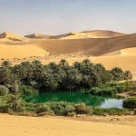
No. A wadi is a watercourse that stays dry most of the time, while an oasis has a reliable, ongoing water source from an aquifer. Some oases sit along wadi routes, but the two terms describe different features.
How much advance warning do flash floods in wadis typically give?
Very little by definition. NOAA’s flash-flood criteria specify onset within six hours of the triggering rainfall, and at the flood’s actual location, the visible warning can be a matter of minutes.
Why are slot canyons even more dangerous than open wadis?
Their narrow, steep-walled shape channels floodwater with more force and gives people caught inside far fewer options to climb out or reach higher ground, compared to a wider, open wadi bed.
Is arroyo just the American term for wadi?
Functionally, yes. Both describe a normally dry channel that floods suddenly after rainfall. The different names reflect regional usage, Middle East and North Africa versus the American Southwest, rather than a different landform.