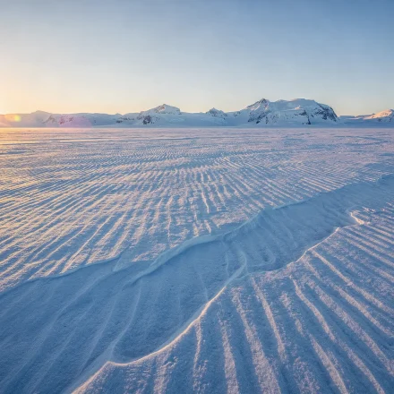


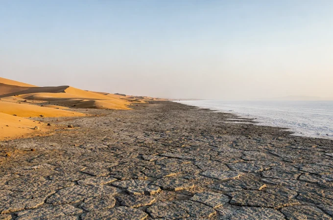
Sand dunes get all the attention. In fact, they are one of the rarer desert landforms. Most desert ground on Earth is rock, gravel or hardpan, rather than the sweeping dune seas of postcards and films.
Table Of Content
- What Makes Desert Landforms Different
- The Six Desert Landforms
- 1. Sand dunes and ergs
- 2. Rock deserts and stone pavements
- 3. Badlands and erosion landscapes
- 4. Salt flats and playas
- 5. Desert oases
- 6. Wadis and flash floods
- Why Desert Landforms Look So Dramatic
- The Ranking Most People Get Wrong
- What Decides Which Landforms a Desert Has
- How the Six Connect to Each Other
- Named Regions Worth Knowing
- How to Read a Desert Landscape
- Why This Matters for a Trip
- Related Categories
- FAQ
- Which desert landform is most common worldwide?
- Are desert landforms permanent?
- Can one desert contain all six landform types?
- Which landform is most hazardous for travelers?
- Do all six landforms appear in every desert?
- What is the difference between hamada and reg?
- Is one landform more scientifically important than the others?
- What does aeolian mean?
What Makes Desert Landforms Different

Two forces shape desert terrain: wind and water. Neither is unique to deserts, of course. Wind erodes rock everywhere, and water carves channels everywhere.
What changes in a desert is what gets in the way. Almost nothing does.
Elsewhere, vegetation anchors soil, slows runoff and softens the impact of rain. Strip it away, however, and both forces run unchecked. Desert rainfall then compounds the effect, because it arrives rarely but hits hard when it finally comes.
As a result, a wide range of terrain packs into short distances. Shifting dunes, bone-dry salt pans and canyon-cut badlands can sit inside one country, and sometimes inside a single national park.
The Six Desert Landforms

1. Sand dunes and ergs
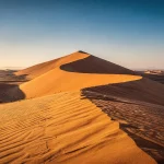
Wind sorts sand into shapes. Barchan, star, linear and transverse dunes each record a different wind pattern. Although sand seas are the least common of the six landforms, they remain by far the most photographed. Sand Dunes and Ergs covers how each type forms.
2. Rock deserts and stone pavements
Hamada is bare rock plateau, while reg is gravel plain. Together they cover the actual majority of the world’s desert area. In practice, most of any trip is spent standing on them. Rock Deserts and Stone Pavements explains both surfaces.
3. Badlands and erosion landscapes
Soft sediment plus near-zero vegetation produces some of the fastest visible erosion on the planet. For example, Spain’s Tabernas looks so much like the American West that Sergio Leone shot his spaghetti westerns there in the 1960s. Badlands and Erosion Landscapes covers the process behind that terrain.
4. Salt flats and playas
Ancient lakebeds sit in closed drainage basins with no outlet. Water arrives, evaporates, and leaves its minerals behind. Repeat that cycle for long enough and eventually only salt remains. Salt Flats and Playas explains the sequence.
5. Desert oases
An oasis is a groundwater story rather than a lucky accident. Aquifer geology decides where water reaches the surface, so the location is entirely predictable once you know the rock beneath. Desert Oases covers how that works.
6. Wadis and flash floods
Dry riverbeds can turn dangerous within minutes. Often the rain falls somewhere else entirely, upstream and out of sight, which is exactly what makes the hazard so hard to read. Wadis and Flash Floods covers it in full.
Why Desert Landforms Look So Dramatic

Erosion here is not faster than elsewhere in principle. Instead, it is simply visible.
A single flash flood can carve a new channel in hours, while a vegetated landscape would need decades to show the same change.
Meanwhile, that same absence of cover preserves the record. Layered sediment, ancient lakebeds and wind-carved textures stay exposed instead of vanishing under topsoil and root systems.
Because of that, a badlands cliff face can show millions of years of deposits in one view. Almost anywhere else on Earth, the same history sits buried.
The Ranking Most People Get Wrong

Rock and gravel cover far more desert area worldwide than sand does.
Even the Sahara works this way. Although popular imagery pictures it as endless dunes, ergs make up a minority of its surface, while the rest splits between rock plateau, gravel plain and mountain. Both National Geographic and the USGS survey of desert geology and resources set this out plainly.
That single fact overturns most people’s mental picture before they ever set foot in a desert.
It carries a practical edge too. Arriving expecting dunes and finding a flat gravel plain is a common disappointment, yet a few minutes of reading prevents it entirely.
What Decides Which Landforms a Desert Has
Three variables do most of the work.
First, rock and sediment type. Soft sediment gives badlands, whereas harder bedrock gives hamada.
Second, wind regime. Steady wind from one direction builds barchan dunes, while wind arriving from several directions builds star dunes.
Third, rainfall pattern. Deserts with rare but intense storms produce wadis, badlands and salt flats. By contrast, deserts with almost no storms at all tend toward dune fields and rock pavement instead. Desert Rainfall Patterns and Flash Floods covers the difference.
This is why two deserts with the same aridity and the same formation mechanism can still look nothing alike on the ground.
How the Six Connect to Each Other
These are not six unrelated categories. On the contrary, they run on shared physics.
Dunes and stone pavements sit at opposite ends of one wind-driven process. Geologists call it aeolian, after Aeolus, the Greek god of wind. Dunes are built by accumulation, whereas pavements are what remains after deflation, where wind strips the fine material out and leaves the coarse behind.
Badlands, salt flats and wadis, by contrast, are all water stories. Rare but powerful rainfall acting on ground with nothing to protect it.
Oases are the exception in the set, since they are the one case where water reaches the surface reliably rather than violently.
Once you know a desert’s climate mechanism from How Deserts Form, the terrain becomes partly predictable. A coastal fog desert that almost never sees a rainfall event will rarely produce badlands. Meanwhile, a continental interior desert with occasional violent storms is a much likelier wadi setting.
Named Regions Worth Knowing
A handful of places anchor each landform type in most people’s minds:
- Sand seas — Erg Chebbi in Morocco, the Rub’ al Khali across Arabia.
- Rock desert — the Sahara’s hamada plateaus and reg plains.
- Badlands — Tabernas in Spain, Badlands National Park in South Dakota.
- Salt flats — Salar de Uyuni in Bolivia.
- Oases — Huacachina in Peru, the Western Desert oases of Egypt.
- Wadis — Wadi Rum in Jordan.
None of these is the only example of its type. Each, however, is documented well enough to serve as a reliable reference point. World Deserts Atlas maps the rest.
How to Read a Desert Landscape
A few signs tell you what you are standing on, without any equipment at all.
- The ground itself. Loose sand that shifts underfoot means erg. A tight mosaic of flat stones with no fine material between them means reg, and that pavement took thousands of years to form.
- Layering in a cliff or slope. Horizontal bands of different color mean sediment laid down over time. That is the badlands signature.
- Channels. A flat-bottomed, steep-sided trench with rounded pebbles in it is a wadi, even if it has been dry for years. The pebbles give it away, since only moving water rounds a stone.
- White crust. Salt pans read as bright and flat from a distance, and crunch underfoot up close.
- Green. In true desert, green means groundwater. It is never random.
Britannica’s survey of desert environments covers the vegetation patterns behind that last rule.
Why This Matters for a Trip
The dominant landform shapes almost everything about a visit.
Terrain underfoot decides footwear and vehicle. Photography changes completely between a dune field and a gravel plain. So do the specific risks: a wadi-heavy route carries a flash-flood consideration that a stable hamada plateau simply does not.
Therefore, check which landform actually dominates a destination rather than assuming dunes. It is a small step, yet it changes what you pack and which season is safe to travel.
Related Categories
How Deserts Form · Desert Climate and Weather · Desert Definition and Classification · World Deserts Atlas
FAQ
Which desert landform is most common worldwide?
Rock and gravel terrain, meaning hamada and reg. In fact, sand seas cover a genuinely smaller share of global desert area than popular imagery suggests, even in deserts as dune-associated as the Sahara.
Are desert landforms permanent?
It depends on the type. Dune fields shift and reshape over years to decades, whereas badlands and canyons change over much longer timescales. Even so, a single flash flood can alter them dramatically in hours.
Can one desert contain all six landform types?
Yes. Large deserts like the Sahara hold dune seas, rock pavement, salt flats and wadis side by side, because local wind, water and geology vary across a desert’s area, sometimes over just a few hundred kilometers.
Which landform is most hazardous for travelers?
Wadis, specifically because of flash-flood risk. Ground that looks completely safe and dry can turn dangerous within minutes, and the warning time is usually very short.
Do all six landforms appear in every desert?
No. Climate mechanism, geology and history decide which occur where. For instance, a coastal fog desert can show completely different terrain from a continental interior desert at the same aridity level, since rainfall intensity and rock type diverge sharply between them.
What is the difference between hamada and reg?
Hamada is bare rock plateau, scoured clean. Reg, by contrast, is a plain of gravel and pebbles left behind after wind removed the fine material. Both count as rock desert, and both are far more common than sand.
Is one landform more scientifically important than the others?
Not really, since each preserves different information. Badlands and salt flats record deep climate history, oases reveal groundwater systems, while dune fields show current wind patterns in real time.
What does aeolian mean?
It means wind-driven, from Aeolus, the Greek god of winds. Geologists use it for any landform built or shaped by wind, which therefore covers both dunes and stone pavements.