

What is a desert, in precise terms? Two numbers decide it: how much rain falls, and how much the climate could have evaporated if it had the chance.
Table Of Content
- What Is a Desert? The Precipitation Threshold
- Why Rainfall Alone Isn’t Enough
- The Köppen System’s “BW”
- The UN’s Aridity Index Scale
- Which System Should You Actually Trust?
- Why This Matters Beyond Semantics
- How Scientists Verify These Numbers
- Why This Matters Beyond Semantics
- FAQ
- Why does Antarctica count as a desert if it’s covered in ice?
- Is 250 mm a strict cutoff everywhere?
- What’s the difference between the Köppen system and the UN’s Aridity Index?
- Who actually built this classification, and when?
- What do the other Köppen letters (A, C, D, E) mean, if B is arid?
- How confident are scientists in these classifications for remote deserts?
What Is a Desert? The Precipitation Threshold
The most commonly cited threshold is 250 millimeters of rain per year; below that line, a region is generally considered arid enough to qualify as desert. Between roughly 250 and 500 mm, the more moderate “semi-arid” classification applies instead, covered in full on Desert vs. Semi-Arid vs. Steppe. This single number is the one most travel content leans on, but it is a simplification of a more precise underlying system, covered in full below.
Why Rainfall Alone Isn’t Enough

Two regions can receive identical rainfall and have completely different desert status, because the second half of the equation is potential evapotranspiration (PET): a measure of how much moisture the local temperature, wind, and humidity conditions could pull out of the ground and plants if water were available. A hot, dry, windy climate has high PET; a cool, humid one has low PET. When PET exceeds precipitation by enough of a margin, the water deficit defines a desert regardless of the raw rainfall number; which is exactly why a place receiving more total rainfall than another can still be the more genuinely arid of the two.
As an illustration: a location receiving 300 mm of rain a year with very low PET might stay just outside desert classification, while a hotter location receiving the same 300 mm, but with PET high enough to demand 600 mm to break even, qualifies as desert on the same rainfall total.
The Köppen System’s “BW”
The most widely used climate classification was developed by Wladimir Köppen, a German-Russian climatologist trained first as a botanist: a background that shows in how closely his climate categories track real vegetation boundaries rather than reading as an abstract temperature-and-rainfall grid. The system’s letter code works in layers: the first letter marks the main climate group (A tropical, B arid, C temperate, D continental, E polar). The “W” subtype (BW, standing for the German Wüstenklima, desert climate) marks true desert, where annual precipitation comes in under half that calculated threshold; 50–100% of the threshold is instead classified semi-arid (“BS”).
The UN’s Aridity Index Scale
For tracking desertification risk globally, the UN Convention to Combat Desertification uses a finer, four-band scale built on the same Aridity Index math (precipitation ÷ potential evapotranspiration): hyper-arid (below 0.05), arid (0.05–0.20), semi-arid (0.20–0.50), and dry sub-humid (0.50–0.65). Together these four bands cover just over 40% of Earth’s land surface outside Antarctica; true desert specifically (the hyper-arid and arid bands) is a smaller slice within that total.
A distinction most casual “how much of Earth is desert” answers skip entirely. National meteorological agencies and agricultural planners lean on this scale more than Köppen’s for exactly this reason: it flags land trending toward desertification years before it would cross Köppen’s harder BW line.
Which System Should You Actually Trust?
Neither is “more correct” as they answer different questions. Köppen tells you what climate zone a specific point on a map belongs to. The Aridity Index tells you how close a place sits to crossing a threshold, useful for tracking change over time: the same tracking that underlies What Is Desertification & Why Is It Spreading?.
Why This Matters Beyond Semantics
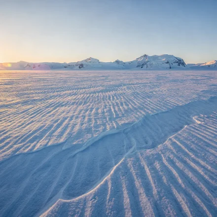
These formal thresholds are why climatologists confidently classify Antarctica as the world’s largest desert, a fact explored fully in The 5 Types of Deserts: its annual precipitation is extremely low, and the frozen ground cannot release meaningful moisture. The label has nothing to do with sand or heat, and everything to do with the water-balance math above: the same math that separates real deserts from the merely dry-looking places covered in Desert Myths & Misconceptions, Debunked.
How Scientists Verify These Numbers
Both systems depend on long-running weather-station records (decades of consistent rainfall and temperature readings) which is why remote deserts with sparse station coverage sometimes carry wider error bars on their exact classification than well-monitored regions do. Satellite-based rainfall estimates have narrowed this gap substantially over the past two decades, letting agencies refine borderline classifications that older, ground-station-only data left ambiguous. This is also why the exact boundary between a true desert and its neighboring How Deserts Form mechanism can shift slightly as monitoring improves, even when the underlying climate hasn’t changed at all.
Why This Matters Beyond Semantics
These formal thresholds are why climatologists confidently classify Antarctica as the world’s largest desert, a fact explored fully in The 5 Types of Deserts: its annual precipitation is extremely low, and the frozen ground cannot release meaningful moisture. The label has nothing to do with sand or heat, and everything to do with the water-balance math above: the same math that separates real deserts from the merely dry-looking places covered in Desert Myths & Misconceptions, Debunked.
FAQ
Why does Antarctica count as a desert if it’s covered in ice?
Because the classification is based on precipitation and evapotranspiration, not temperature or the presence of ice; Antarctica’s snowfall, converted to its water equivalent, is extremely low annually.
Is 250 mm a strict cutoff everywhere?
It is the most commonly cited threshold, but the Köppen system’s actual calculation adjusts for local temperature, meaning the precise cutoff varies slightly by region.
What’s the difference between the Köppen system and the UN’s Aridity Index?
Köppen draws one line (BW/BS, desert or not), calculated from temperature; the UN’s Aridity Index is a continuous ratio (precipitation ÷ PET) split into four bands, used specifically for tracking desertification risk.
Who actually built this classification, and when?
Wladimir Köppen published the first version in 1884; Rudolf Geiger extended it after Köppen’s death in 1940, which is why it now carries both their names.
What do the other Köppen letters (A, C, D, E) mean, if B is arid?
A marks tropical climates, C temperate, D continental, and E polar; desert (B) is defined by water balance rather than temperature band.
How confident are scientists in these classifications for remote deserts?
Generally high, though sparse weather-station coverage in remote regions historically introduced some uncertainty; modern satellite rainfall data has significantly closed that gap.